
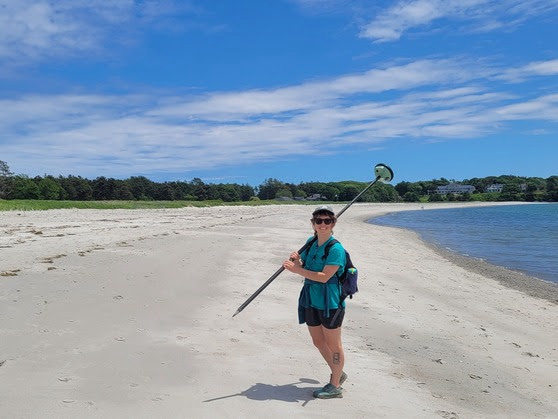
MGS coastal geology intern Jeannette Berman collected most of the data for the 2024 MBMAP season, spending her summer walking 42 sandy beaches from Kittery to Bristol. (MGS Photo)
|
AUGUSTA – The Department of Agriculture, Conservation and Forestry’s Maine Geological Survey (MGS) has updated its Maine Beach Mapping (MBMAP) viewerwith the latest data collected during the summer of 2024. The MBMAP program, initiated by MGS in 2005, monitors changes in Maine's dunes and beaches over time, with a focus on the seaward edge of dominant dune vegetation. Since 2017, MGS has also mapped the mean high-water contour to track beach erosion and changes in dry beach width. This comprehensive data collection helps assess the health of Maine's coastal ecosystems.
The 2024 updates, largely compiled by MGS coastal geology intern Jeannette Berman (photo included below), who surveyed 42 sandy beaches from Kittery to Bristol, reveal significant shifts in Maine’s coastal landscape. The data includes detailed information on shoreline, dune, and beach changes, now accessible to the public via the MBMAP viewer.
Key features of the updated viewer include:
MGS uses the highly accurate Real-Time Kinematic (RTK) global positioning system to collect shoreline data. This system allows MGS to measure changes in beach and dune positions with precision down to a few centimeters, which is crucial for monitoring the subtle yet significant shifts in coastal environments over time. By providing real-time corrections to satellite data, RTK ensures that MGS can track shoreline and elevation changes with exceptional accuracy, making it an invaluable asset in understanding the long-term impacts of erosion, sea level rise, and storm events on Maine’s beaches.
For a complete analysis, users can view the Beach Change Summary Statistics Over Previous Year and Overall Beach Change Summary Statistics tables, which offer detailed data on beach, dune, and dry beach width changes.
To assist users, the viewer includes a video tutorial and a frequently asked questions section. Data can also be downloaded in geographic information system (GIS) applications.
For more information and to access the MBMAP viewer, visit https://www.maine.gov/dacf/mgs/hazards/beach_mapping/index.shtml.