

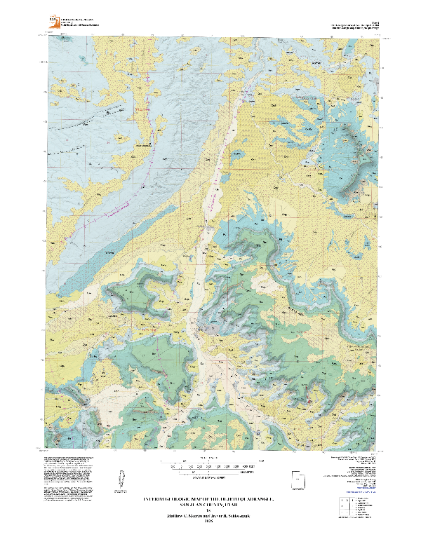
The Utah Geological Survey (UGS), in partnership with the Navajo Nation, is announcing the publication of a new geologic map for the Oljeto 7.5' quadrangle. This map is a collaboration of the Utah Geological Survey and the Navajo Nation Department of Water Resources. It represents the first-ever formal geologic mapping by the UGS within the Navajo Nation, setting a new precedent for how tribal priorities can help guide scientific research.
Unlike traditional mapping initiatives, this project began with a simple question. Prior to beginning its research, the UGS approached leadership and resource managers within the Navajo Nation to ask a fundamental question: What are your priorities, and how can our science serve them?
The answer from the Nation was clear and urgent: groundwater.
Mapping Water in a Dry Landscape
The Oljeto quadrangle covers a striking and hyper-arid slice of the Colorado Plateau straddling the Utah-Arizona border, encompassing portions of Monument Valley. In a region where surface water is nearly nonexistent, and development continues to stress local resources, mapping what lies beneath the surface provides critical data to help decision makers take informed action in natural resource management.
Geologic maps act as a blueprint of the Earth's architecture. By carefully charting the area's rock layers, fault lines, and sediment distributions, the new map provides the Navajo Nation with data needed to understand groundwater resources, manage existing wells, and safely develop future infrastructure.
"From the start of this project, we knew we needed tribal involvement to ensure maximum value for the Tribe. We are proud to have worked directly with the Navajo Nation to produce a map that helps address their water security concerns."
— Dr. Matthew Morriss, UGS Project Geologist and Lead Mapper
"Through communication and partnership with the Utah Geological Survey, the Navajo Nation was able to increase technical capacity and resources needed to complete the Oljeto 7.5' quadrangle mapping project, learn more about the geology in the region and the relationship with the groundwater supply."
— Dr. Crystal Tulley-Cordova, Navajo Nation Department of Water Resources Principal Hydrologist
The project was spearheaded on the UGS side by project geologist Dr. Matthew Morriss and senior geologist Trevor Schlossnagle. Both researchers expressed excitement about the partnership, noting that working closely with tribal authorities enriched the scientific process.
The collaborative framework ensured that data sharing was transparent and that the final map products were tailored specifically to assist the Navajo Nation Department of Water Resources and local chapters. Funding for this project was made possible through the U.S. Geological Survey (USGS) STATEMAP program, a component of the National Cooperative Geologic Mapping Program. The STATEMAP program plays a critical role nationwide by matching federal funds with state geological surveys to produce high-priority maps that address urgent societal needs, from infrastructure planning to natural hazard mitigation. Geologic mapping serves as the foundational framework for all earth science applications. Without these detailed maps, resource managers and other stakeholders would lack the critical data necessary to make informed decisions regarding groundwater security, responsible land use, and smart development.
Both organizations view the Oljeto quadrangle as the foundation for a long-term scientific alliance that respects tribal sovereignty while tackling pressing natural resources challenges.
The Oljeto quadrangle geologic map is now publicly available through the Utah Geological Survey's Map Portal and has been formally delivered to the Navajo Nation leadership.